SAIPAN, APRIL 15, 2026 —
One of the most powerful tropical cyclones ever recorded this early in the year slammed into American territory in the Pacific on Tuesday, pounding the Northern Mariana Islands and Guam with catastrophic winds, torrential rainfall, and flooding that tore roofs off buildings, flipped cars, and sent residents scrambling for shelter as flying debris turned streets into danger zones.
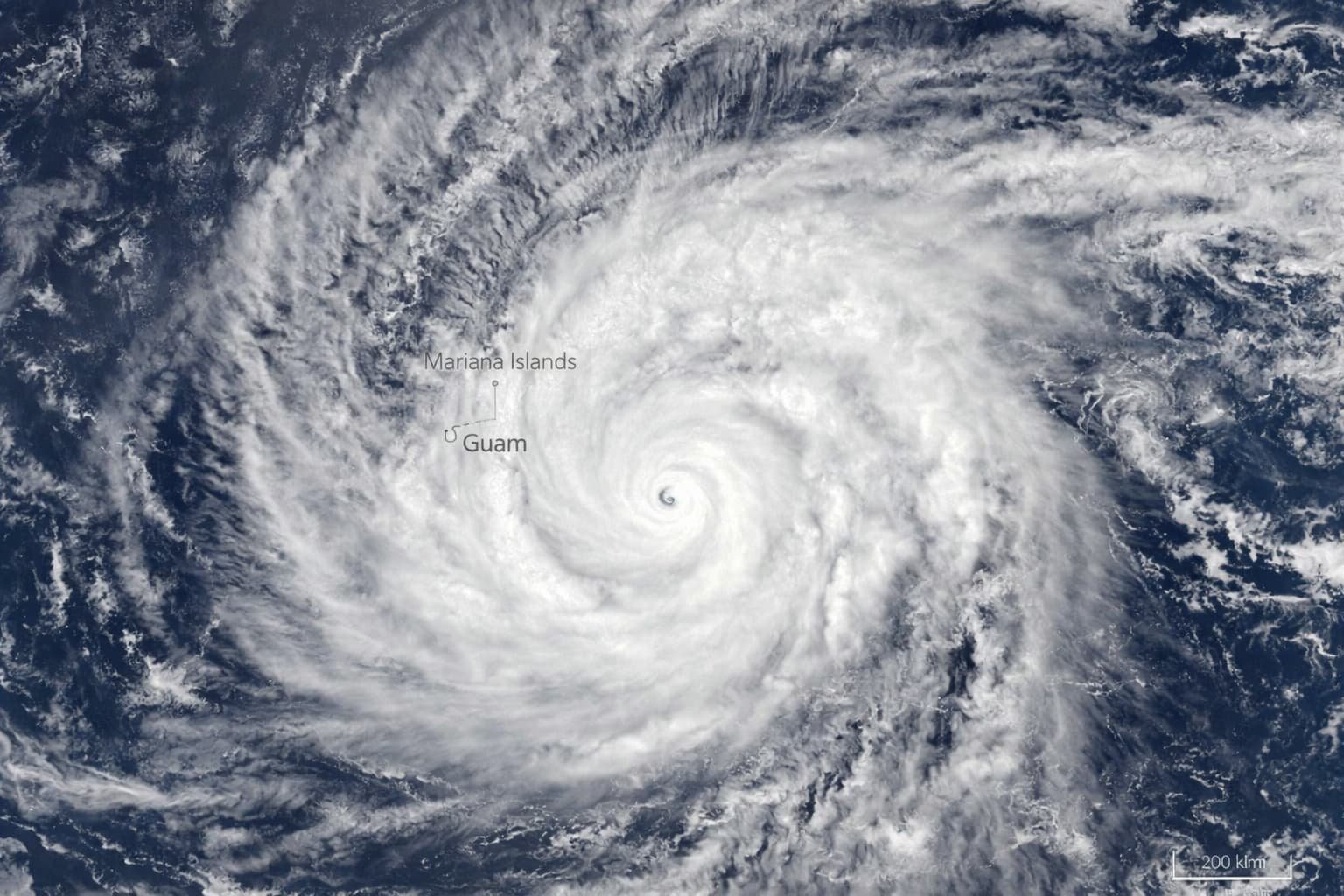
Super Typhoon Sinlaku made landfall on the islands of Saipan and Tinian as a Category 4 equivalent storm, following an earlier peak intensity of sustained winds of 185 mph — placing it among only a handful of typhoons ever recorded with such ferocity so early in the calendar year. The storm struck the approximately 50,000 residents of Saipan and Tinian before tropical-force conditions extended south to Guam, home to roughly 170,000 people and three major U.S. military installations.
The Destruction Unfolding on the Ground
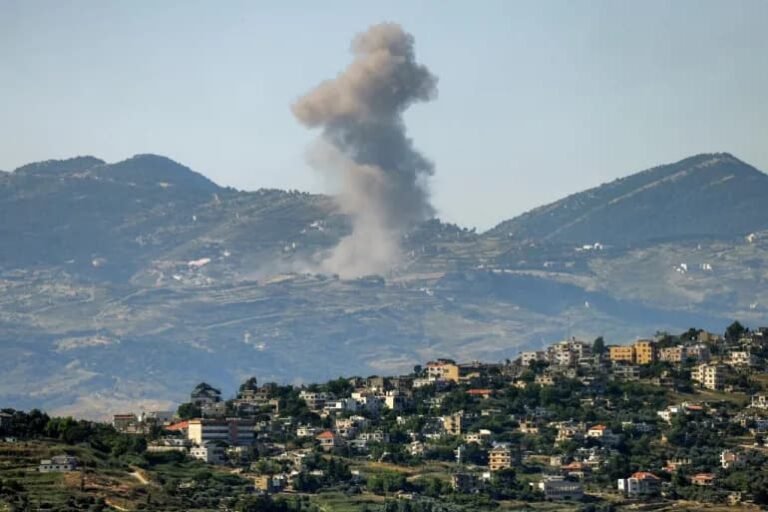
Saipan Mayor Ramon Camacho described the scene in blunt terms as the storm bore down: objects flying left and right, wooden and tin structures collapsing, residents in need of rescue while winds and rain made any response dangerous.
In the Susupe village on Saipan, the storm tore the roof off a commercial building, snapped mature tree branches throughout the island, and left a blue sedan flipped on its side in the street. A resident captured video of a car sitting on top of two others in an apartment complex parking lot. Part of a residential balcony railing was torn away. Guam reported downed power lines, roads flooded under a foot of water, and wind gusts peaking at 88 mph during the worst of the storm’s outer bands Tuesday night local time.
The American Red Cross and its partners were sheltering more than 1,000 residents across Guam and the Northern Marianas as the storm continued. Flash flood warnings remained in effect with forecasters warning of 15 to 25 inches of total rainfall across Saipan and Tinian — a deluge that could trigger widespread landslides and structural flooding long after the winds subside.
Guam’s school system closed for Tuesday and Wednesday, with officials stating schools would remain shut until the governor declared conditions safe. The island’s water authority reported multiple power outages throughout the island and warned residents to remain indoors and away from floodwaters.
What Made Sinlaku Exceptionally Dangerous
Super Typhoon Sinlaku reached peak intensity with sustained winds of 185 mph and a central pressure of 890 millibars — tying with Super Typhoon Hester from 1953 as the second strongest typhoon ever recorded from January through April, surpassed historically only by Super Typhoon Surigae from April 2021.
Before intensifying to that peak, the storm underwent an eyewall replacement cycle — a phenomenon typically seen only in the most powerful tropical cyclones, in which a new ring of thunderstorms forms around the original eye wall, causes the original to collapse, and temporarily weakens the storm before it can restrengthen. In Sinlaku’s case, the process caused it to slow dramatically in its forward motion, meaning it hovered near the islands for hours rather than passing through quickly — dramatically amplifying the total wind energy and rainfall delivered to land.
The storm’s behavior was also climatologically unusual. Typhoons in the Western Pacific can occur at any time of year, but peak season typically runs from July through November. A Category 5-equivalent storm in mid-April is rare and has prompted meteorologists to examine whether warming ocean surface temperatures in the Western Pacific are extending the window during which extreme tropical cyclones can form and sustain catastrophic intensity.
| Super Typhoon Sinlaku — Key Facts | Data |
|---|---|
| Peak sustained winds | 185 mph |
| Minimum central pressure | 890 millibars |
| Equivalent Atlantic category | Category 5 |
| Primary impact areas | Saipan, Tinian, Guam (U.S. territories) |
| Combined affected population | ~220,000 residents |
| FEMA staff deployed | ~100 |
| Rainfall forecast (Saipan/Tinian) | 15–25 inches |
| Historical ranking | 2nd strongest Jan-Apr typhoon on record |
Federal Response and Military Implications
President Trump approved emergency disaster declarations for both Guam and the Northern Mariana Islands ahead of the storm’s arrival, triggering the release of federal disaster assistance funds and authorizing FEMA to coordinate multi-agency support. Nearly 100 FEMA staff were deployed, alongside additional federal personnel from other agencies.
The military dimension of Guam’s vulnerability adds urgency to any federal response. The U.S. military controls approximately one-third of Guam’s total land area, and the island serves as a critical hub for American forward presence in the Pacific — including forces that would be central to any response involving the Korean Peninsula, Taiwan, or the broader Indo-Pacific theater. Power outages and infrastructure damage to U.S. military facilities on Guam are a matter of national security as well as local emergency management.
As of Wednesday morning local time, tropical-force winds of 75 mph or greater were still being recorded and were expected to continue through Wednesday afternoon. Conditions were forecast to remain dangerous for an additional day and a half after that, as the slowly moving storm dragged its outer bands across the islands before finally curving toward the sparsely populated volcanic islands of the far northern Marianas chain and out over open Pacific.
Full damage assessments will not be possible until winds drop to safe levels — meaning the true scale of destruction on Saipan and Tinian may not be fully known until Thursday at the earliest.